[ Home ] [ Library ] [ Index ] [ Maps ] [ Links ] [ Search ] [ Email ]
|
"Srebrenica story" - A journey through evidence and documents.
July 1995 | ||
| ||
|
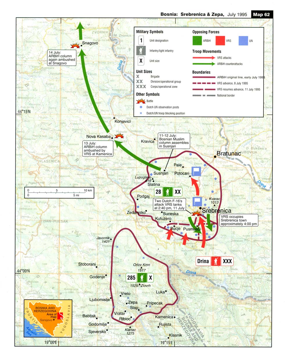
The above map clearly explains why round 2,000 Srebrenica Muslims lost their lives. The decision that the 28th Muslim Division should refuse to lay down its arms and embark on a break-through along a 100km-long route in the hardest of military operations, for which it was not prepared in view of the prior retreat of command personnel, amounted to a conscious sacrifice of round two thousand Muslim men of military age. The Western allies would do their best to present it as no less than genocide. They would any trick they could think of to boost the number. They will lie that 8,000 Srebrenica Muslims perished and that the Serbs, in cold blood, executed these men. [ UN officer reveals the trick ] [ Srebrenica "massacre" ]
|
|
Where am I? PATH:
|